
St Anton Map | Arlberg Map
Illustrated St Anton Ski Piste Map with Ski Lifts and Gondolas | Unframed Art Print | Available in A4 & A3 size
£11.00
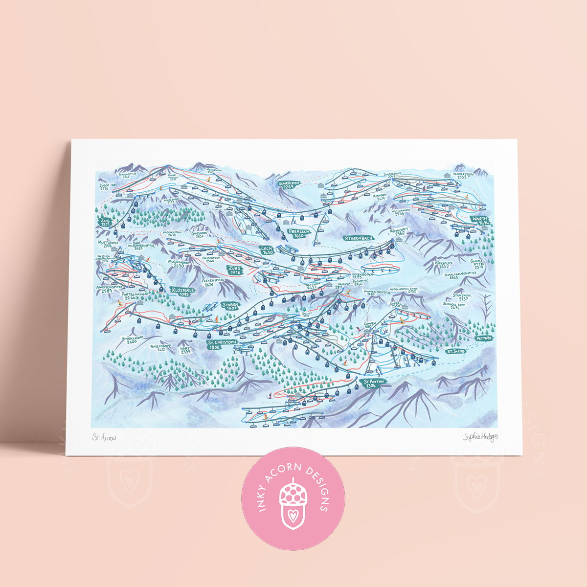
This intricate unframed map of St Anton & The Arlberg Ski Area was illustrated by Sophie Hodges (Inky Acorn Designs) and is printed onto 190gsm cotton acid free fine art paper and signed by her. It comes in a biodegradable display bag with a greyboard backing board with a little info slip on Inky Acorn Designs in the back.
It makes a wonderful gift for anyone who has spent time in St Anton & The Arlberg Ski Area and would like to display a bit of it's charm on their wall!
The places featured on the map include: the wonderful peaks around the St. Anton area including Braunalspitze, Trittkopf, Valluga and Kapall and the ski villages and towns of St. Anton, Lech, Zurs, St Jakob, Zug, Warth and others. Most of the lifts around the ski area are included and I've marked chairlifts with a little chair going up the lifts, gondolas / cable cars are marked with a little bubble and button / drag lifts with a little skier being pulled up them. Most of the mountain restaurants are marked with a little grey mountain hut and I've tried to include all the blue runs, red runs and black runs around the ski resort too!
It is available in A5, A4 or A3 sizes. Please select your chosen option from the drop downs.
All designs are copyright by Sophie Hodges for Inky Acorn Designs and may not be copied, reproduced or sold for commercial profit or fed into any form of AI without her express permission. For licensing, please contact inkyacorndesigns@gmail.com.
Connect
Stay updated with updates on upcoming markets and new work by following my socials:
Info
Contact
© 2025. All rights reserved.